
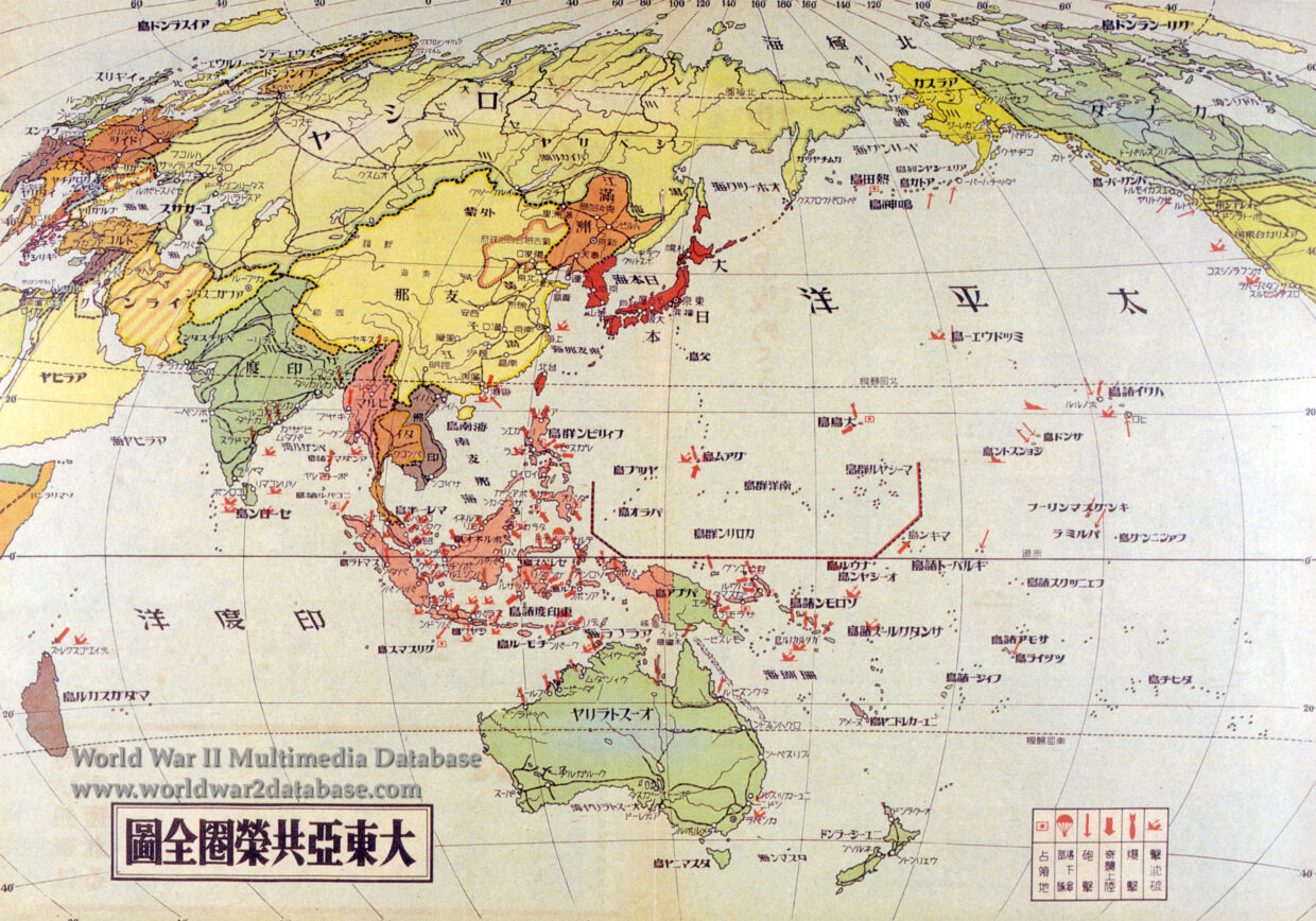
| Japanese map of the Pacific published a year after Pearl Harbor showing extent of Japanese expansion and sight of major naval engagements, sinkings along the United States west coast, and colonies coded by color. | |
| Image Filename | wwii1230.jpg |
| Image Size | 2.58 MB |
| Image Dimensions | 3000 x 2099 |
| Photographer | Unknown |
| Photographer Title | |
| Caption Author | Jason McDonald |
| Date Photographed | December 06, 1942 |
| Location | |
| City | |
| State or Province | |
| Country | Japan |
| Archive | |
| Record Number | |
| Status | Caption ©2007, ©2024 MFA Productions LLC Please Do Not Duplicate or Distribute Without Permission |
Author of the World War II Multimedia Database